| The Regional Impacts of Climate Change |
| The Regional Impacts of Climate Change |
|
|
|
| Other reports in this collection | |
|
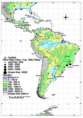
6.1. Regional Characteristics
The Latin American region spans a vast geographic and ecological range, from
the subtropics of the Northern Hemisphere to the subpolar tip of the South American
subcontinent; the region's largest portion lies in the tropical zone. The region
consists of 20 independent states and the territory of French Guiana (an overseas
department of France) (see Box 6-1 and Figure
6-1).
Major biogeographical areas to the south of the Amazon forest include the woody Cerrado/Cerradinho and Chaco ecosystems and, further south, the Pampean region of Argentina. Extending southward from a latitude of 40°S, the Patagonian tableland-a region of vast steppe-like plains-rises westward from about 100 m on the coastline to about 1,000 m at the base of the Andes, with a surface area of about 670,000 km2. Other important ecosystems in the region are the Yunga valleys in Bolivia and tropical/subtropical forests in Paraguay, Brazil, and Argentina. In recent decades, these forests have been subject to strong anthropogenic pressures to increase agricultural land area. For instance, only 4% of the tropical forest originally covering eastern Paraguay remained in the mid-1950s. South America also has important coastal and inland wetlands with very high
biodiversity; the combined biodiversity of these ecosystems and of Latin America's
tropical, subtropical, and temperate ecosystems represents the world's largest
genetic pool. Annex D of this report provides the number of known and endemic
mammal, bird, and flowering plant species in each of the Latin American countries.
The most important freshwater wetlands are those of El Pantanal (Brazil) and
Iberá (Argentina). These wetlands are associated with the large international
Rio de la Plata basin (embracing about 5.1 million km2), whose main component
rivers-Paraguay, Paraná, and Uruguay-have a discharge of 79,400 m3/s. Integration
with the Orinoco (70,000 m3/s) and Amazonas (180,000 m3/s) basins makes this
area the largest running surface-water system in the world (329,400 m3/s), accounting
for approximately 35% of global runoff and covering an area of about 12 million
km2. These very important river systems could be adversely affected by climate
change and mismanagement of associated ecosystems, particularly further deforestation
and, inter alia, deterioration of the buffer capacity of inland wetlands. The
importance of the Amazon basin is depicted in Table 6-1.
Table 6-2 provides the estimated deforestation rate
of each country within this basin.
|
|
Other reports in this collection |