|
7.1. Regional Characterization and Baseline Conditions
This chapter addresses 21 countries of the predominantly arid and semi-arid
region of the Middle East and central Asia (see Figure
7-1 and Box 7-1). The region extends from Turkey in
the west (26°10'E) to Kazakstan in the east (86°30'E), and from Yemen in the
south (12°42'N) to Kazakstan in the north (50°30'N). The relief is mostly low.
The highest point is Communism Peak in Tajikistan (7,495 m); the lowest point
is the Dead Sea in Israel (-395 m). Many countries in the region are landlocked.
|
Box 7-1. Middle East and Arid Asia
|
Afghanistan
Bahrain
Iran, Islamic Republic of
Iraq
Israel
Jordan
Kazakstan
Kuwait
Kyrgyz Republic
Lebanon
Oman |
Pakistan
Qatar
Saudi Arabia
Syria
Tajikistan
Turkey
Turkmenistan
United Arab Emirates
Uzbekistan
Yemen |
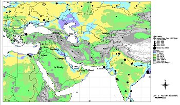 |
| Figure 7-1: The Middle East and Arid Asia region [compiled by the
World Bank Environment Department Geographic Information System (GIS) Unit]. |
Although it is common to separate semi-arid, arid, and extreme arid parts of
a country/region, they are amalgamated for most purposes in this chapter and
(for conciseness) referred to as "arid" unless a specific distinction is needed.
In the Second Assessment Report (SAR), much of this region was discussed in
the chapters on deserts (see IPCC 1996, WG II, Chapter 3) and rangelands (see
IPCC 1996, WG II, Chapter 2).
Because there are few statistics specifically for arid parts of the region,
statistics for whole countries have been used. Data collection is sparse for
many countries in the region, for a range of social and physical reasons. Economic
and social statistics often are unavailable for countries that were part of
the FSU. In addition, with the exception of Kazakstan, few countries have studied
the impacts of climate change in this region. The brevity of this chapter reflects
the lack of available published literature. This lack of data would have to
be addressed in the near future, especially for some sectors (e.g., fisheries).
The region is vulnerable to climate change because it is dry and water availability
is thus limited. In some countries, the ability to adapt to the impacts of climate
change will be reduced by a lack of infrastructure.
The region covers approximately 9% of the world's land area. It is dominated
by arid (50%) and semi-arid (11%) lands. The total population is 433 million,
or 8% of the global population. Annual population growth rates range from -6.5%
(Kuwait) to +5.8% (Afghanistan), compared with a world average of 1.6% for 1990-95.
Half of the population lives in urban centers (compared with a world average
of 45%), and 6 of the 21 countries are more than 80% urbanized. The population
density varies between 6 persons/km2 (Kazakstan) and 831 persons/km2 (Bahrain);
the regional average of 38 persons/km2 is lower than the world's mean density
(44 persons/km2).
|