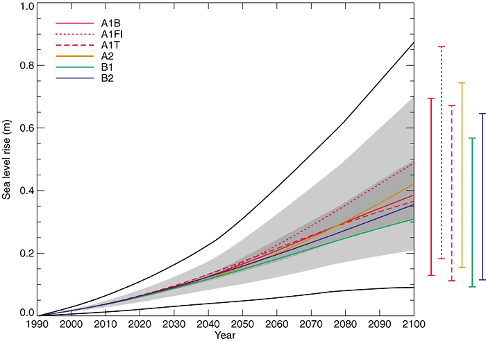
Figure 11.12: Global average
sea level rise 1990 to 2100 for the SRES scenarios. Thermal expansion and land
ice changes were calculated using a simple climate model calibrated separately
for each of seven AOGCMs, and contributions from changes in permafrost, the effect
of sediment deposition and the long-term adjustment of the ice sheets to past
climate change were added. Each of the six lines appearing in the key is the average
of AOGCMs for one of the six illustrative scenarios. The region in dark shading
shows the range of the average of AOGCMs for all 35 SRES scenarios. The region
in light shading shows the range of all AOGCMs for all 35 scenarios. The region
delimited by the outermost lines shows the range of all AOGCMs and scenarios including
uncertainty in land-ice changes, permafrost changes and sediment deposition. Note
that this range does not allow for uncertainty relating to ice-dynamical changes
in the West Antarctic ice sheet. See 11.5.4.3 for
a full discussion. The bars show the range in 2100 of all AOGCMs for the six illustrative
scenarios