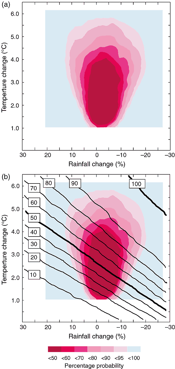
Figure 13.9: (a) Projected
ranges of regional annual temperature and rainfall change for inland southern
Australia in 2100 extrapolated from CSIRO (1996) with temperature sampled randomly
across the projected ranges of both global and normalised regional warming and
then multiplied together. Projected regional ranges for normalised seasonal rainfall
change were randomly sampled, multiplied by the randomly sampled global warming
as above, and then averaged. The resulting probability density surface reveals
the likelihood of different climate change outcomes for this region; (b) Response
surface of irrigation demand for the same region superimposed on projected climate
changes as (a), showing the likelihood of exceeding an annual allocation of irrigation
water supply. Risk can be calculated by summing the probabilities of all climates
below a given level of annual exceedance of annual water supply; e.g., 50%, or
exceedance of the annual water limit in at least one of every two years. (Source:
Jones, 2000b.)