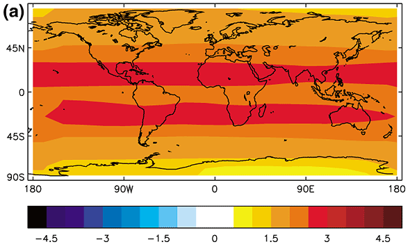
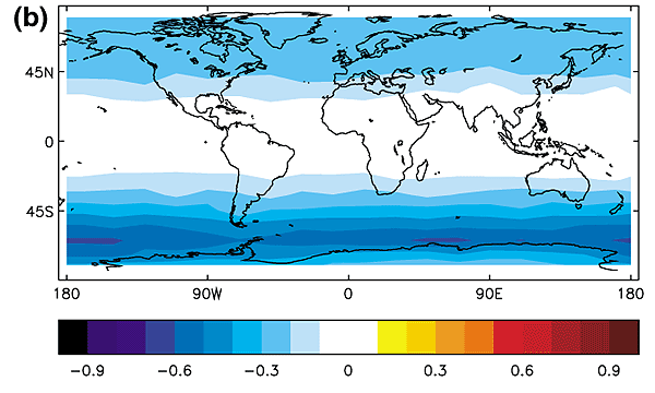
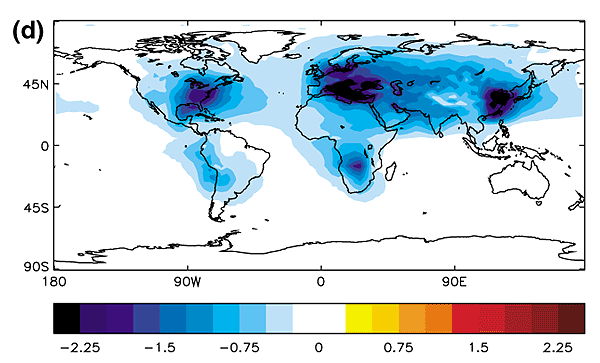
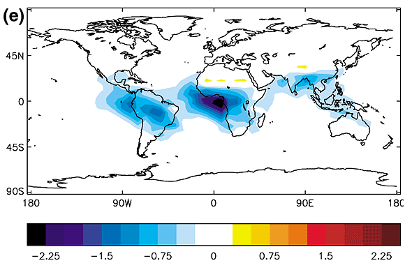
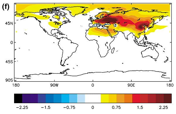
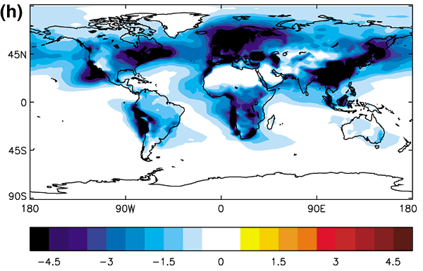
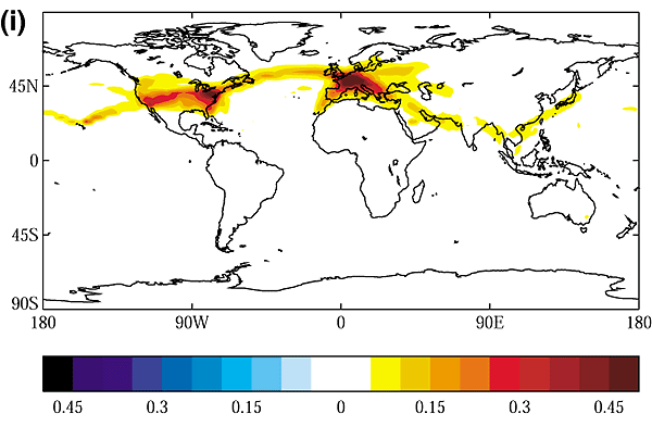
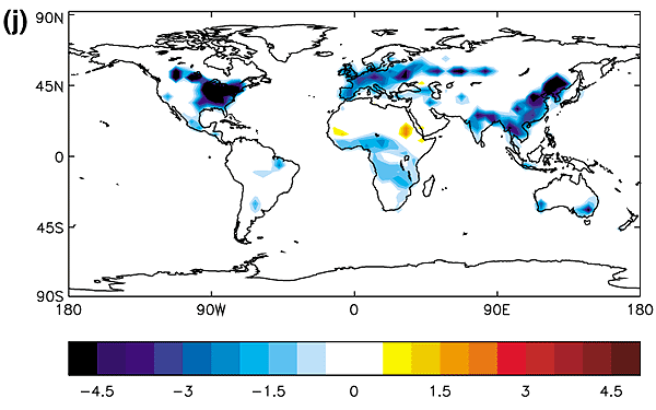
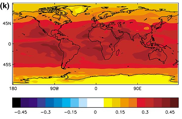
Figure 6.7: Examples of
the geographical distribution of present-day annual-average radiative forcing
(1750 to 2000) due to (a) well-mixed greenhouse gases including CO2 ,CH4 ,N2 O,
CFC-11 and CFC-12 (Shine and Forster, 1999); (b) stratospheric ozone depletion
over the period 1979 to 1994 given by WMO, 1995 (Shine and Forster, 1999); (c)
increases in tropospheric O3 (Berntsen et al., 1997; Shine and Forster, 1999);
(d) the direct effect of sulphate aerosol (Haywood et al., 1997a); (e) the direct
effect of organic carbon and black carbon from biomass burning (Penner et al.,
1998b; Grant et al., 1999); (f) the direct effect of organic carbon and black
carbon from fossil fuel burning (Penner et al., 1998b; Grant et al., 1999), (g)
the direct effect of anthropogenic emissions of mineral dust (Tegen et al., 1996);
(h) the first indirect effect of sulphate aerosol calculated diagnostically
in a similar way to Jones and Slingo (1997), but based on a more recent version
of the Hadley Centre model (HadAM3; Pope et al., 2000), using sulphur emission
scenarios for year 2000 from the SRES scenario (Johns et al., 2001) and including
a simple parametrization of sea salt aerosol (Jones et al., 1999); (i) contrails
(Minnis et al., 1999); (j) surface albedo change due to changes in land use (Hansen
et al., 1998), (k) solar variability (Haigh, 1996). Note that the scale differs
for the various panels. Different modelling studies may show considerably different
spatial patterns as described in the text. (Units: Wm-2