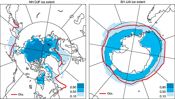
Figure 8.10: Illustration
of the range of sea-ice extent in CMIP1 model simulations listed in Table
8.3: Northern Hemisphere, DJF (left) and Southern Hemisphere, JJA (right).
For each model listed in Table 8.3, a 1/0 mask is
produced to indicate presence or absence of ice. The fifteen masks were averaged
for each hemisphere and season. The 0.5 contour therefore delineates the region
for which at least half of the models produced sea ice. The 0.1 contour indicates
the region outside of which only 10% of models produced ice, while the 0.9 contour
indicates that region inside of which only 10% of models did not produce ice.
The observed boundaries are based on GISST_2.2 (Rayner et al., 1996) averaged
over 1961 to 1990.